Two months ago I have written a small python package pymasker to generate mask from the Quality Assessment band of Landsat 8 image and MODIS land products. This package is gaining popularity, But scripting may not be convenient for users who are not familiar with programming, therefore I create a ArcMap python toolbox based on this package for interactive masking.
The ArcMasking toolbox contains two script tools, one designed for Landsat 8 QA band and one for generic quality assessment bits in other NASA remote sensing products like MODIS.
This tool can be download at GitHub. After unzipping the package, you could open the ArcMasker.tbx file at the Catalog window in ArcMap and find following tools.
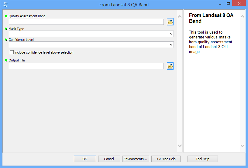
From Landsat 8 QA Band

This tool is used to create masks from the Quality Assessment band of Landsat 8 OLI image. It requires several inputs:
Quality Assessment Band of Landsat 8 image
Mask type including cloud, cirrus, water, snow or vegetation
Confidence Level that indicates the likelihood of existing of specific situation. You can also choose to include confidence level above what has been selected.
Output Mask saving path
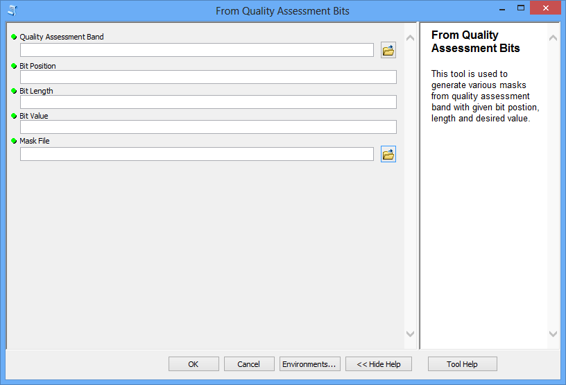
From Quality Assessment Bits

This tool is used to create masks from other NASA remote sensing products with general quality assessment bit like MODIS land products. As each portion of QA bits suggests a certain condition of the image, this toolbox simply examines the value of specific portion of QA bits and generates mask accordingly. Required inputs include:
Quality Assessment Band
Bit Position that indicates where the desired portion of bits starts.
Bit Length that indicates the length of bits.
Bit Value that indicates the desired situation.
Output Mask saving path