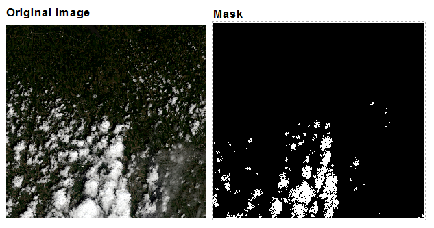
Update Since 0.2.0, the qabmasker has been renamed as landsatmasker and the function getmask has been renamed as getmultimask for better identification. Please update your script accordingly.
Update Since 0.3.0, most class and function names have been updated according to the pep8.
The Quality Assessment (QA) band is a standard product included in each Landsat 8 image downloaded from USGS, which contains the quality information of each pixel such as cloud, snow/ice, water body etc. The detailed information of this band can be found at Landsat 8 Quality Assessment Band.
Although the bits structure of the QA band is easy-to-understand, it would several steps to extract the desired mask in QGIS or L-LDOPE Toolbelt. In this article, I am going to introduce how to use pymasker to generate masks from Landsat 8 QA band in Python. This package is designed to provide a straightforward and intuitive way to generate masks from the QA band. It is an open-source package and the project is hosted at GitHub.
Installation
The package can be shipped to your computer using pip.
1 | pip install pymasker |
Or just install it with the source code.
1 | python setup.py install |
This package depends on numpy. If you want to directly load the QA band file, GDAL is also in need.
Sample
First of all, you need to load the QA band into the qabmaser class.
1 | from pymasker import LandsatMasker |
The QA band contains the detection result of the following four specific conditions for each pixel:
Cloud
Cirrus
Snow/Ice
Vegetation
Water body
For each condition, the algorithm gives a confidence to indicate its existence on the pixel.
1 | from pymasker import LandsatConfidence |
To generate a mask, you need to define a desired confidence for the target condition.
Pymasker provides several functions to get the most commonly used mask. The resulting mask is a binary numpy array with 1 representing existence of specific condition and 0 representing nonexistence.
1 | # Get mask indicating cloud pixels with high confidence |
Pymasker also provides a function for multi-criteria masking. In this function, you need to specify the confidence level of each condition. If you don’t want the function consider one of conditions, you need to set it as confidence.none. Two different masking methods are provided:
Inclusive - Mask pixels that meet at least one of all criteria.
Exclusive - Only Mask pixels that meet all criteria. (default)
Sample code for multi-criteria masking
1 | # Get mask indicating cloud pixels (high confidence) and cirrus pixels (high confidence). |

Now you have your mask! Nice and quick!