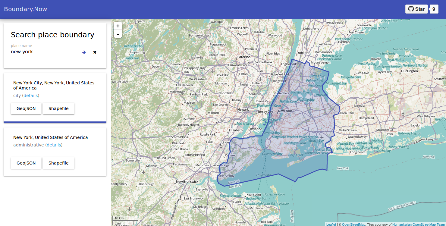
Getting a place boundary is sometimes harder than it looks like.
There are a couple of reasons why it’s hard:
- The boundary data is actually unavailable or not released.
- The boundary data is available, but packaged in a national dataset, like most governmental open data.
- The boundary data is visible, but not downloadable, like the Google map does.
- The boundary data is exportable, but the use is limited, like the Bing map geocoding API does.
So it’s pretty common for a data analyst to take a lot of effort to find and extract place boundaries. It’s even more painful when we have to download national datasets just for a few cities’ boundary.
Oh, wait! Isn’t it a free and global geospatial database out there?
Yeah, OpenStreetMap is awesome and the great Nominatim service allows us to search through the OSM database with a place name.
The only problem is the Nominatim interface is not designed for data extraction, even though the API does return place boundary. So I develop Boundary.Now, an interface for Nominatim geocoding API to download place boundary.

Like the original interface, it will provide a search box for the desired place name. In the result list, only search results with boundary data are shown. The boundary data could be downloaded in GeoJSON, a format widely used in web development, or in Shapefile, a standard format in the GIS world.
You can open the tool here and the project is open at GitHub.